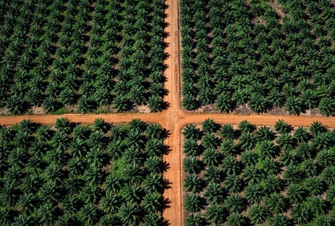
In a move that marries cutting-edge technology with sustainable agriculture, Dabeeo, a leader in geospatial intelligence AI, has launched a new project to monitor palm oil farms in Indonesia. This venture, which spans an impressive 765 square kilometers, covers an area larger than Seoul, South Korea’s bustling capital.
Dabeeo’s latest endeavor is part of a deal with Tunas Sawa Erma Group (TSE), one of Indonesia’s heavyweights in the palm oil industry. The company’s CEO, Ju Hum Park, emphasized the rarity and significance of applying high-precision satellite imagery in agriculture, a domain typically dominated by military and IT applications.
“Seeing satellite imagery applied in agriculture, especially on this scale, is quite rare. This project underscores the versatility of satellite technology, and Dabeeo is at the forefront of this innovative use,” Park stated.
This partnership is not just a feather in Dabeeo’s cap but a strategic leap into a largely untapped market. Park expressed confidence that this move would significantly bolster Dabeeo’s presence in the farm monitoring sector, a field currently devoid of major players.


Building on their initial foray into palm oil farm monitoring in Malaysia last year, Dabeeo is set to make waves in Indonesia. Given that Indonesia and Malaysia produce a staggering 80% of the world’s palm oil, these projects are pivotal for Dabeeo’s expansion strategy.
For almost three decades, TSE Group has been a key player in Indonesia’s palm oil industry. The collaboration with Dabeeo signals a robust entry into the Indonesian market, leveraging AI and ultra-high-resolution satellite imagery to revolutionize traditional farm monitoring.
Current methods, which rely heavily on manual labor and drone footage, are set to be overhauled. Dabeeo’s technology offers a 30-cm-resolution satellite imagery capability, providing comprehensive snapshots of vast areas. With over 99.5% accuracy in detecting palm trees and more than 90% accuracy in assessing their health, this tech ensures early detection of issues like diseased trees, crucial for yield predictions.
Looking ahead, Dabeeo plans to extend its work with TSE Group to include nutrient analysis. By identifying nutrient deficiencies in individual trees through satellite imagery, they aim to optimize fertilization strategies, potentially transforming palm oil farming practices.
Since 2023, Dabeeo has been developing a user-friendly monitoring platform in collaboration with TSE Group, based on its acclaimed “Dabeeo Eartheye.” Recognized as an innovative satellite image-based AI platform at CES 2022, “Dabeeo Eartheye” ensures that even areas with poor internet connectivity can access critical data. With the platform functioning efficiently at speeds as low as 12 Mbps—about 1/14th of South Korea’s average internet speed—farm managers can now make real-time decisions on-site.
Transitioning from specialized GIS systems to a web-based platform accessible to all organization members marks a significant enhancement in farm monitoring. This not only streamlines operations but also enables precise resource allocation, such as timely labor deployment to problem areas, boosting overall farm efficiency.
Dabeeo’s bold venture into Indonesia’s palm oil sector is not just a technological advancement; it’s a pioneering step towards smarter, more sustainable agricultural practices. With their eyes set on the future, Dabeeo is poised to transform the landscape of farm monitoring, one pixel at a time.
(Source: Chem Analyst | Korea Herald)